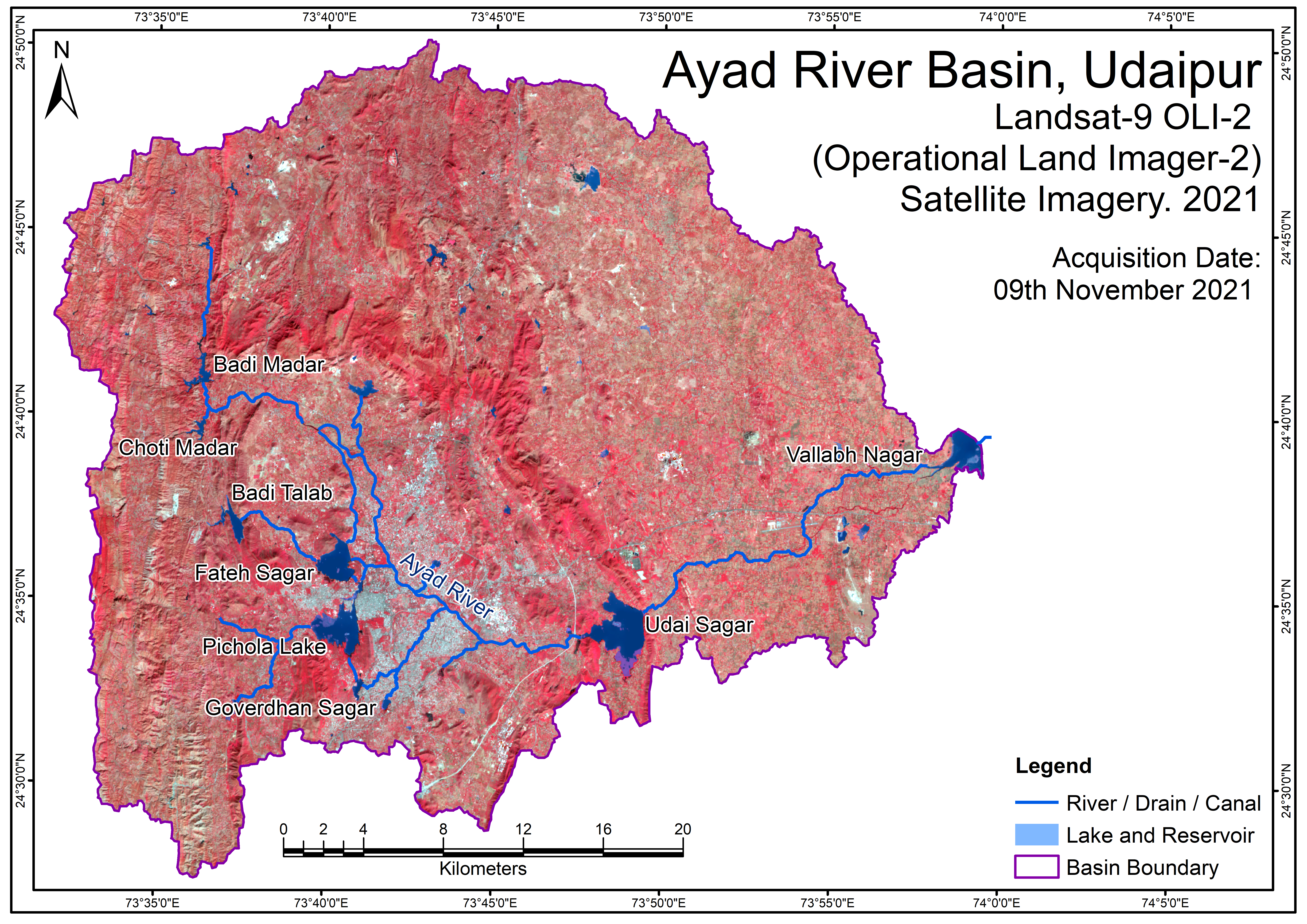
LandUseLandCoverMap 2021
The most valuable natural resource is land, which includes soil, water, and the accompanying plants and wildlife that make up the entire ecosystem. Information on land use helps with planning for development by enabling a better understanding of the land utilization aspects of cropping patterns, fallow areas, forests, grazing lands, waste lands, and surface water bodies. Any terrain's land use pattern reflects the intricate physical processes at play on the earth's surface.
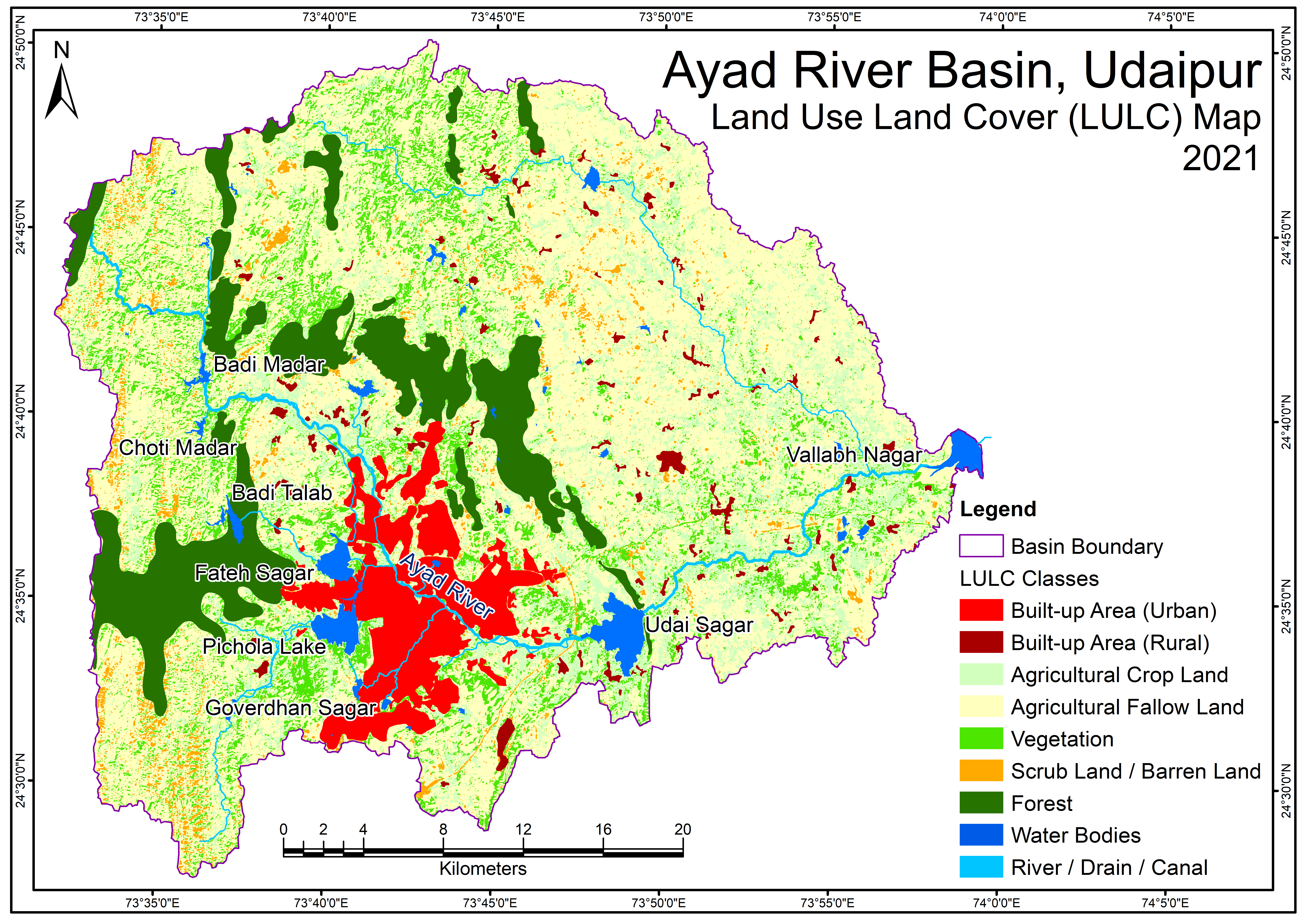
Source: Land use land cover map of the study area has been prepared by using Landsat-9 OLI-2 (Operational Land Imager-2) satellite imageries of year 2021. Digital classification (unsupervised) method has been used for extraction of agricultural crop land, agricultural fallow land, vegetation, scrub - barren land, forest area, water bodies, and river-drain, while traditional visual image interpretation method has been used for digitization of other land use categories, built-up area (urban), and built-up area (rural). As historical high-resolution satellite imageries such as GeoEye, WorldView, QuickBird is also available on GoogleEarth, then these land use / land cover data layers have been verified through best available GoogleEarth satellite imagery.
Tags
Drainage Density Map Drainage Network Map Geological Map - Formation Geological Map - Lithology GroundWater Fluctuation Map v2 Hydrology of Ayad River Basin LandUseLandCoverMap 2011 LandUseLandCoverMap 2021 River Discharge Data Locations Satellite Imagery Map 2011 Satellite Imagery Map 2021 Soil Map v2 Unconfined Aquifer Map Satellite Imagery Map Soil Map Topography (DEM) Map
 Map.png)
Related images
Ayad River Basin Geological Map - Formation
View more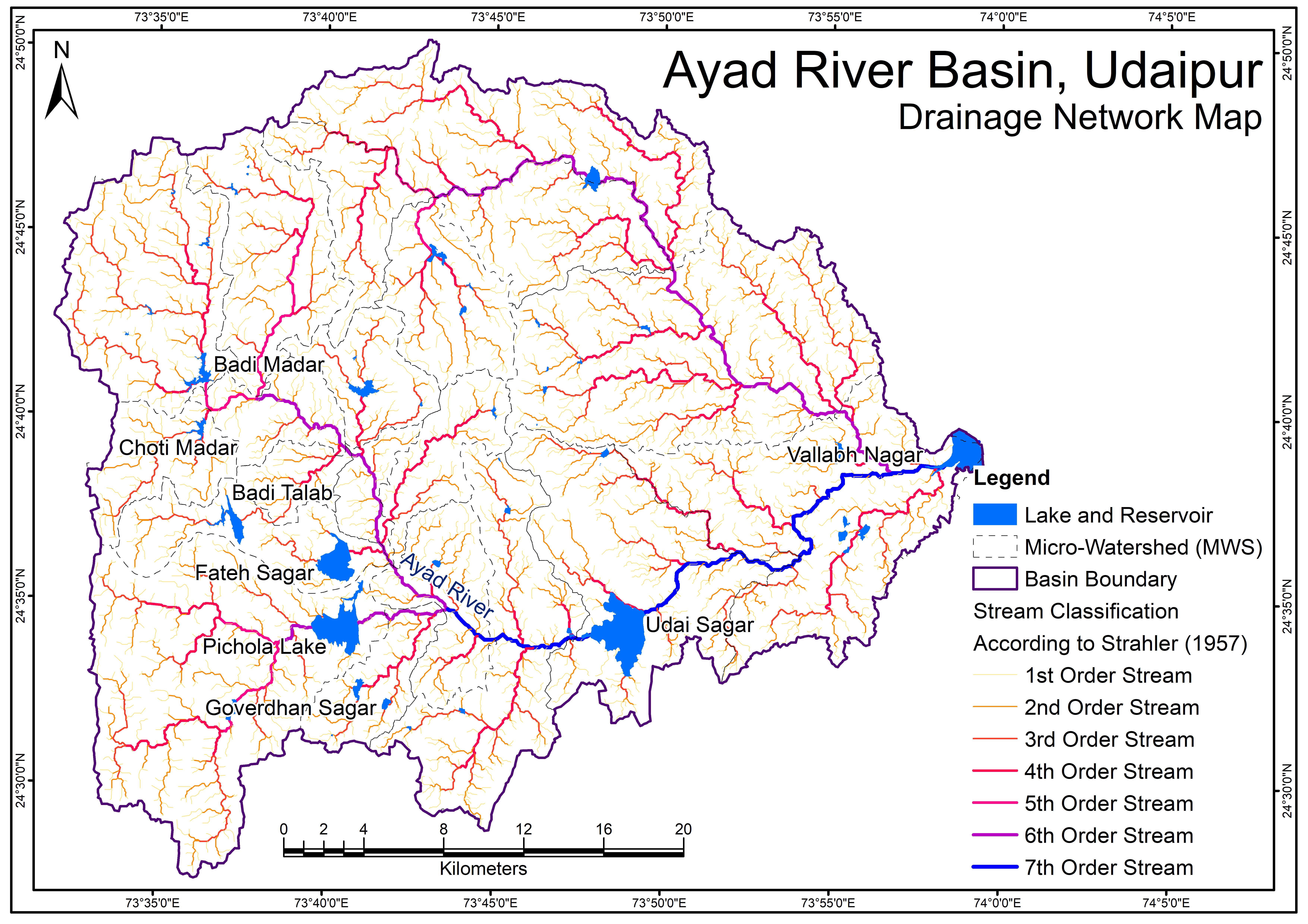
Ayad River Basin Drainage Network Map
View more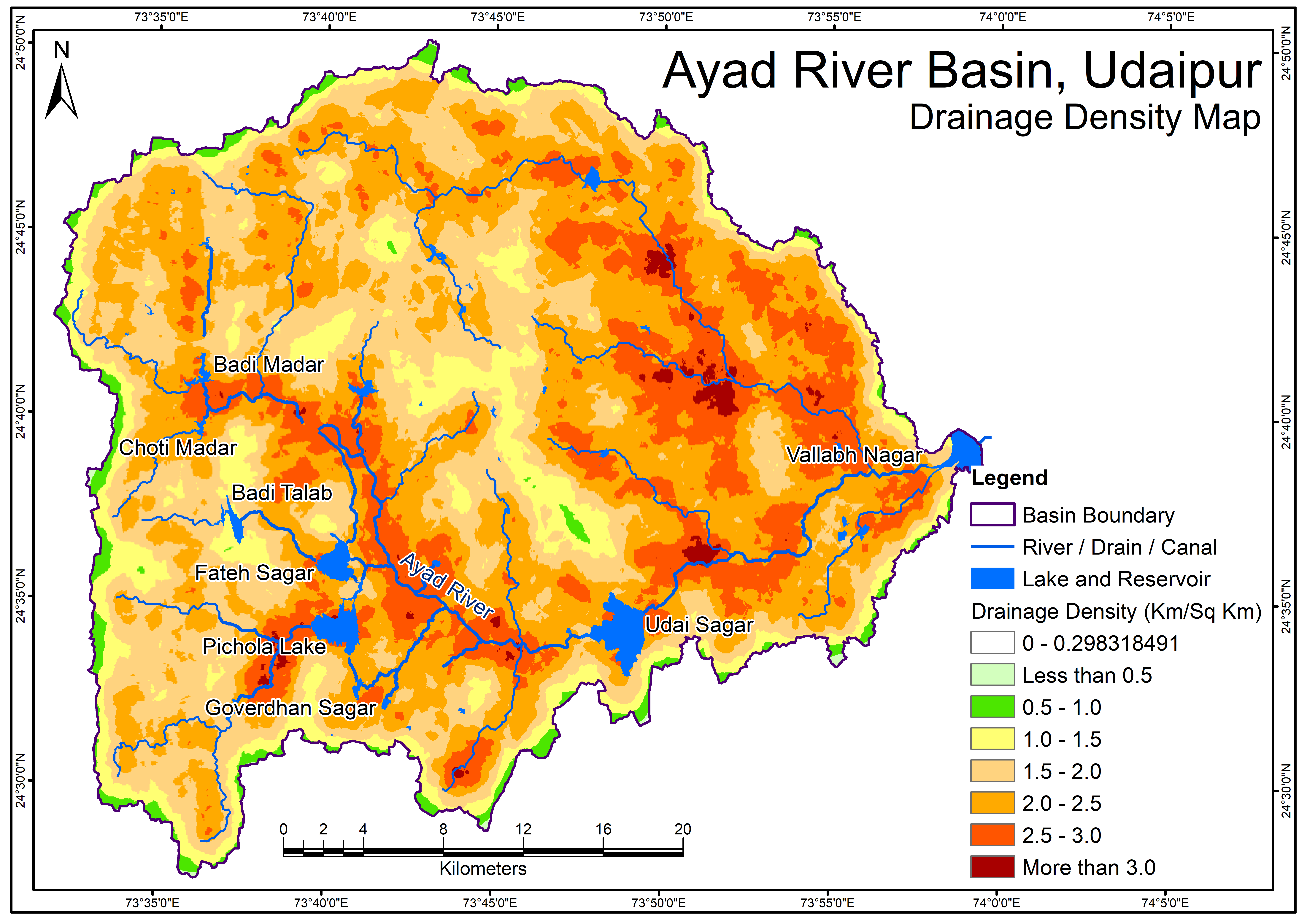
Drainage Density Map
View more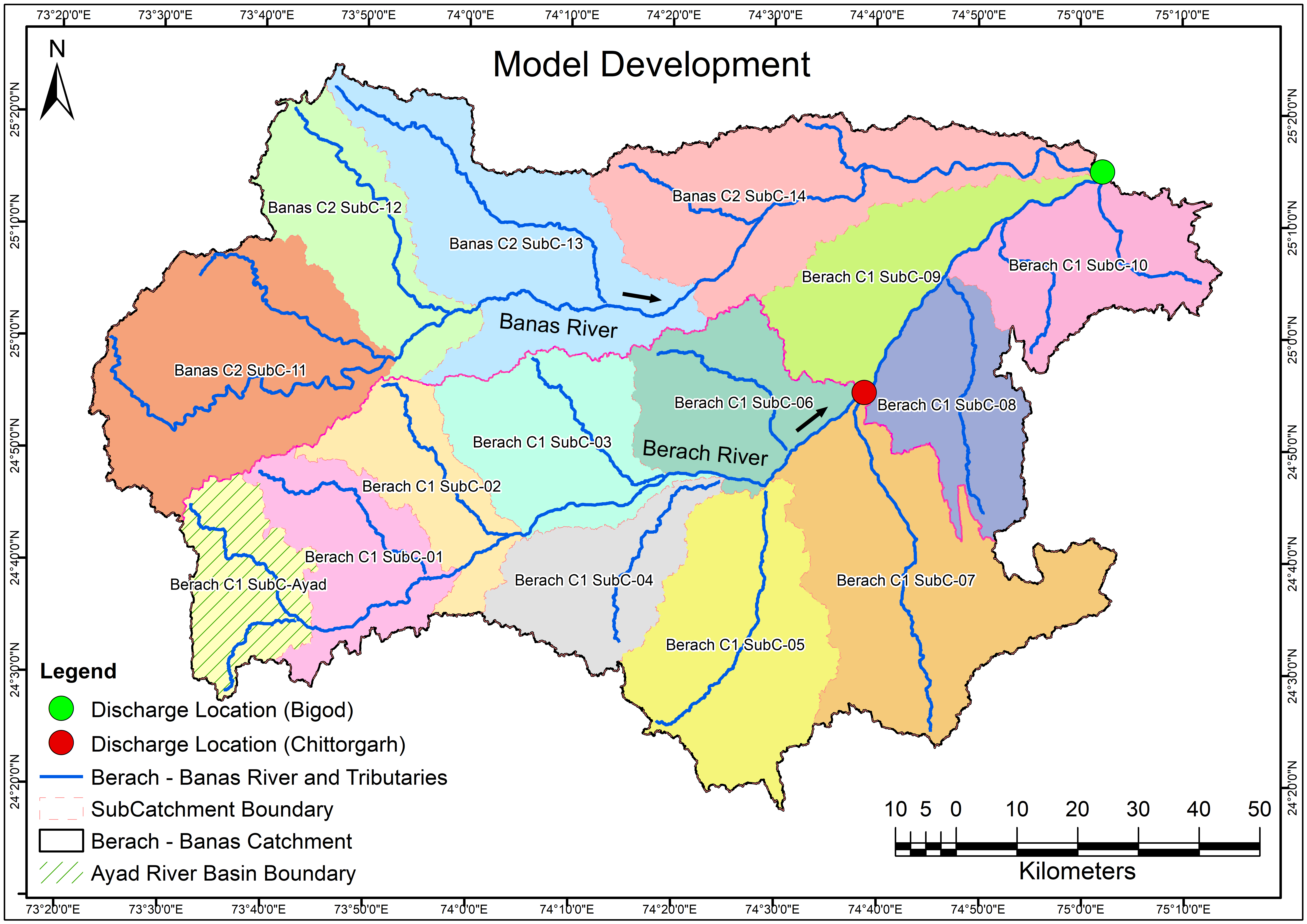
Model Development
View more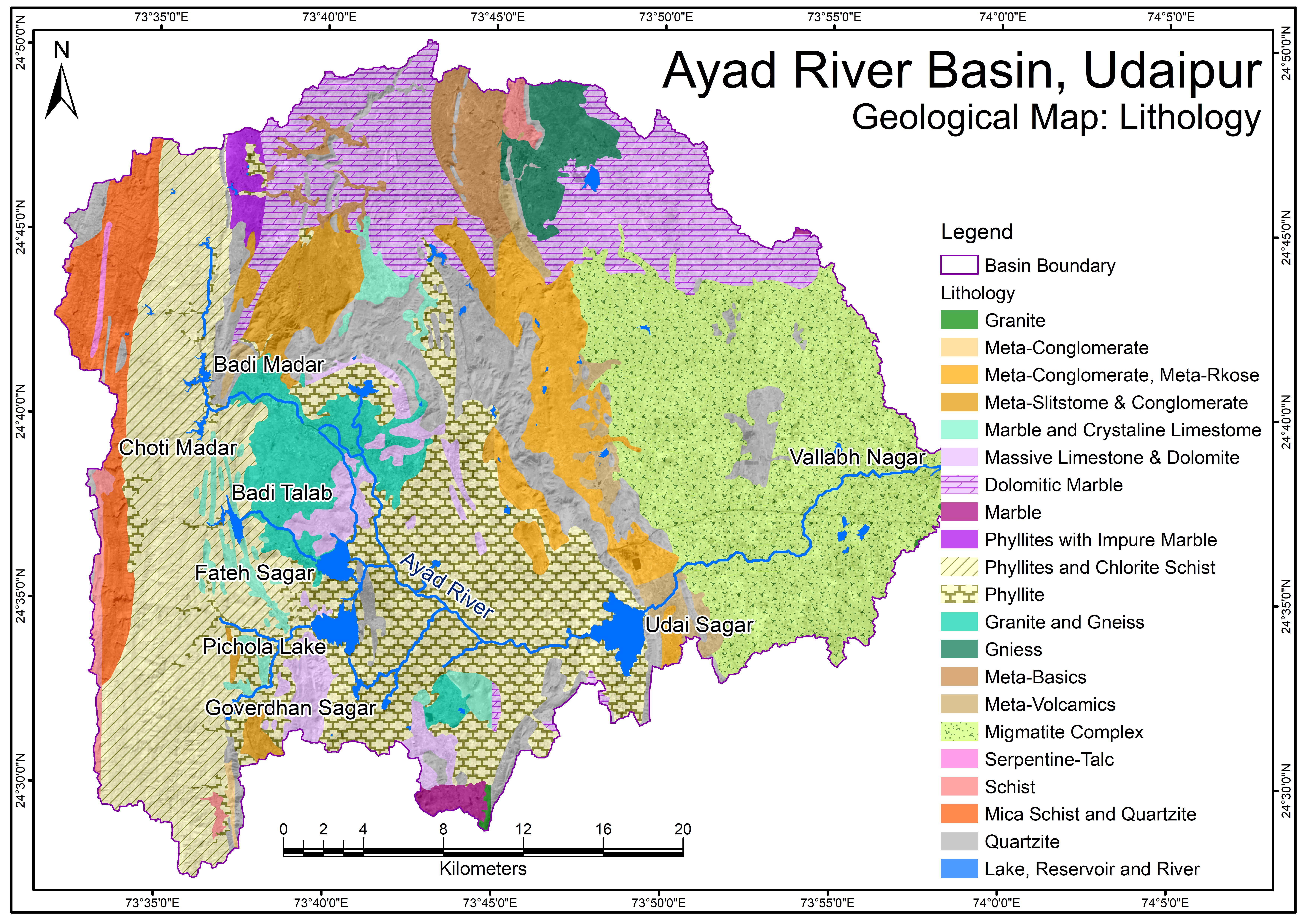
Ayad River Basin Geological Map - Lithology
View more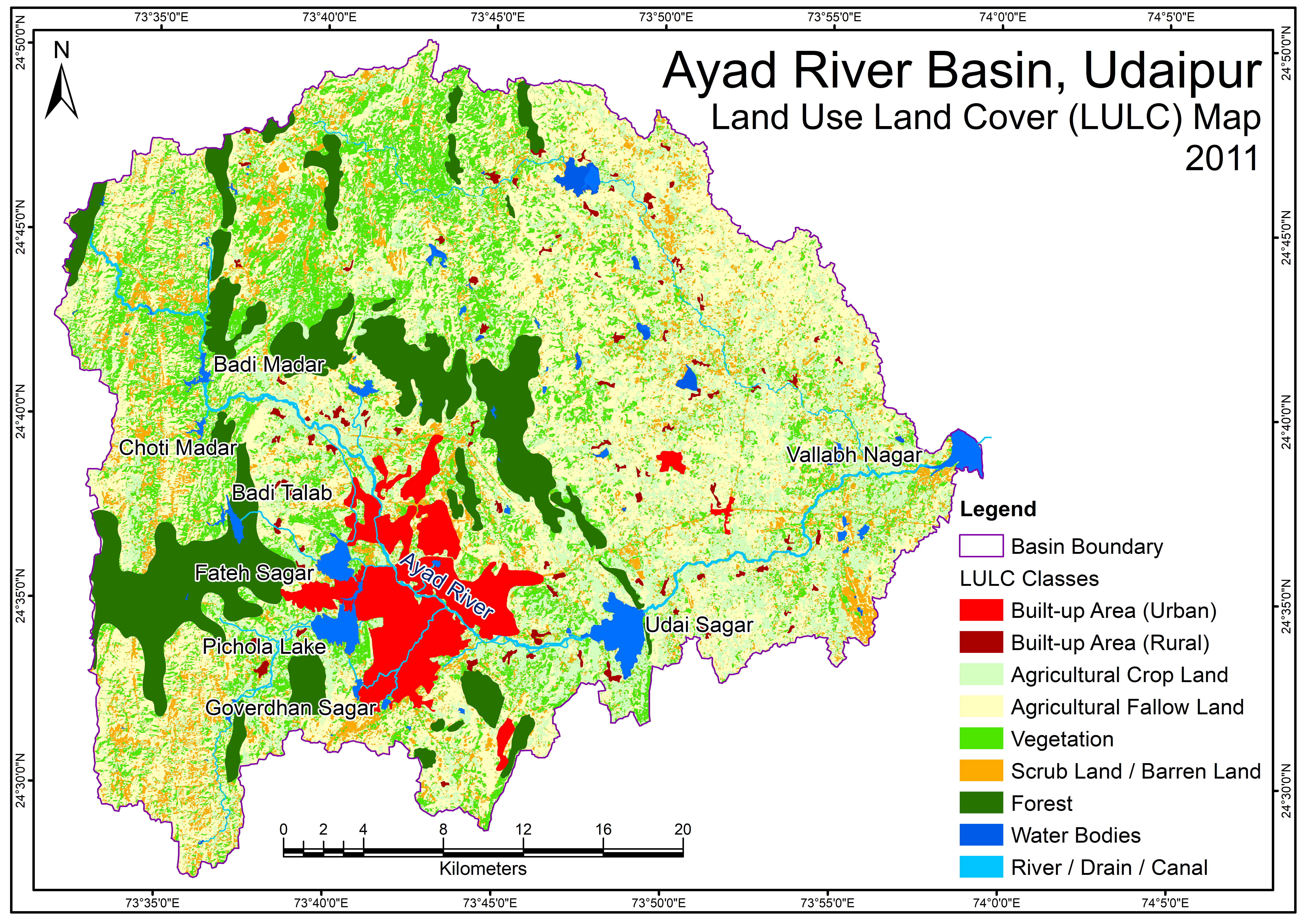
Ayad River Basin LandUseLandCoverMap 2011
View more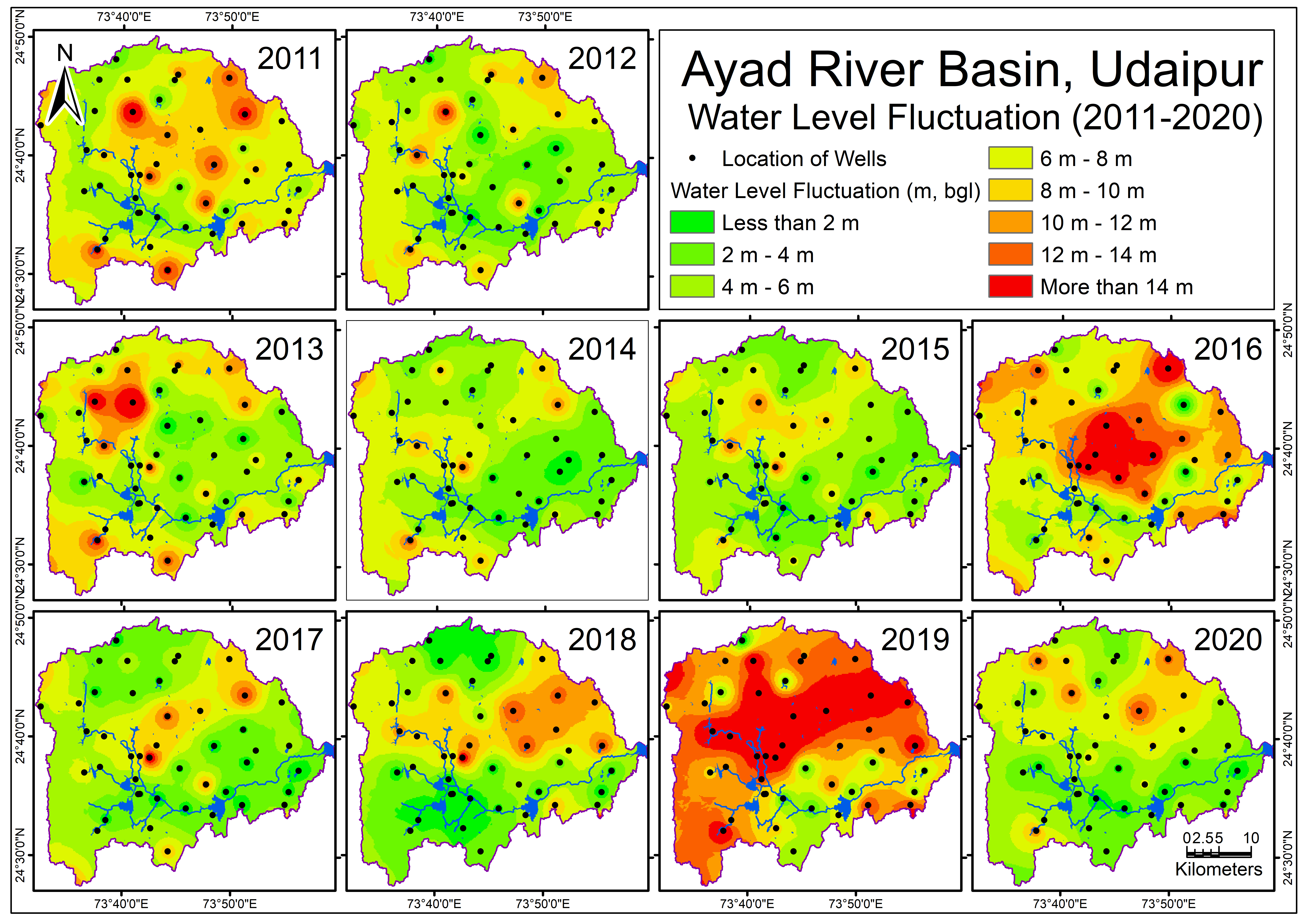
Ayad River Basin GroundWater Fluctuation Map v2
View more