Geophysical Data
Geophysical data is used to provide information on the physical properties of the Earth's surface and subsurface. As a result, geophysical data can help locate hydrocarbons, minerals, aggregate, and other natural resources. Geophysical data can also be used for geologic mapping, hydrology, environmental monitoring, slope stability assessment, infrastructure planning and monitoring.
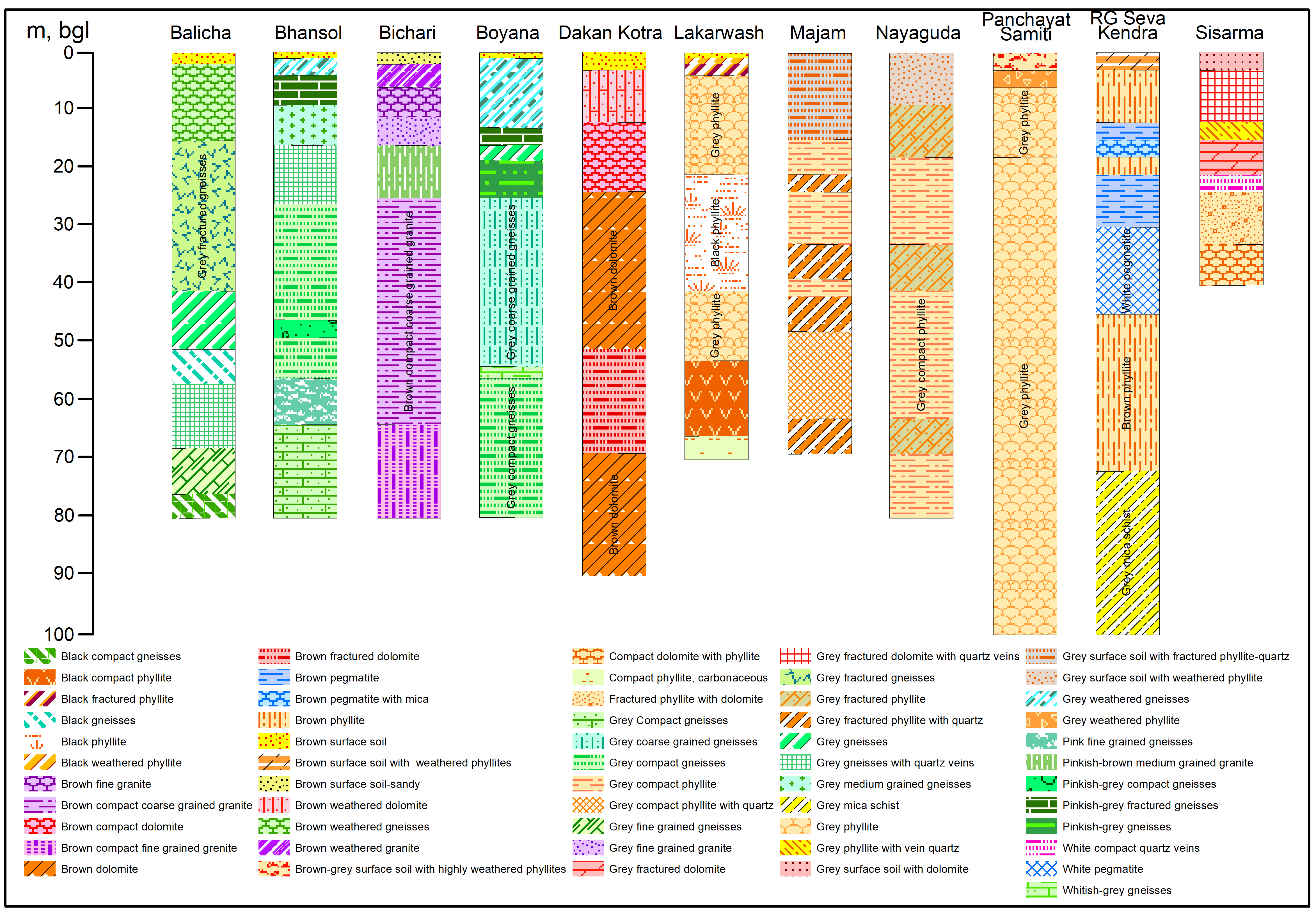
Dataset
(1) Udaipur Lithologs Data (2) Geophysical Data Pumping Test Data (3) Pumping Test Data UdaipurSource: Ground Water Department, Jodhpur (Rajasthan). https://phedwater.rajasthan.gov.in/content/raj/water/ground-water/en/home.html
Dimension: 1920x1080
Format: JPG
Related images
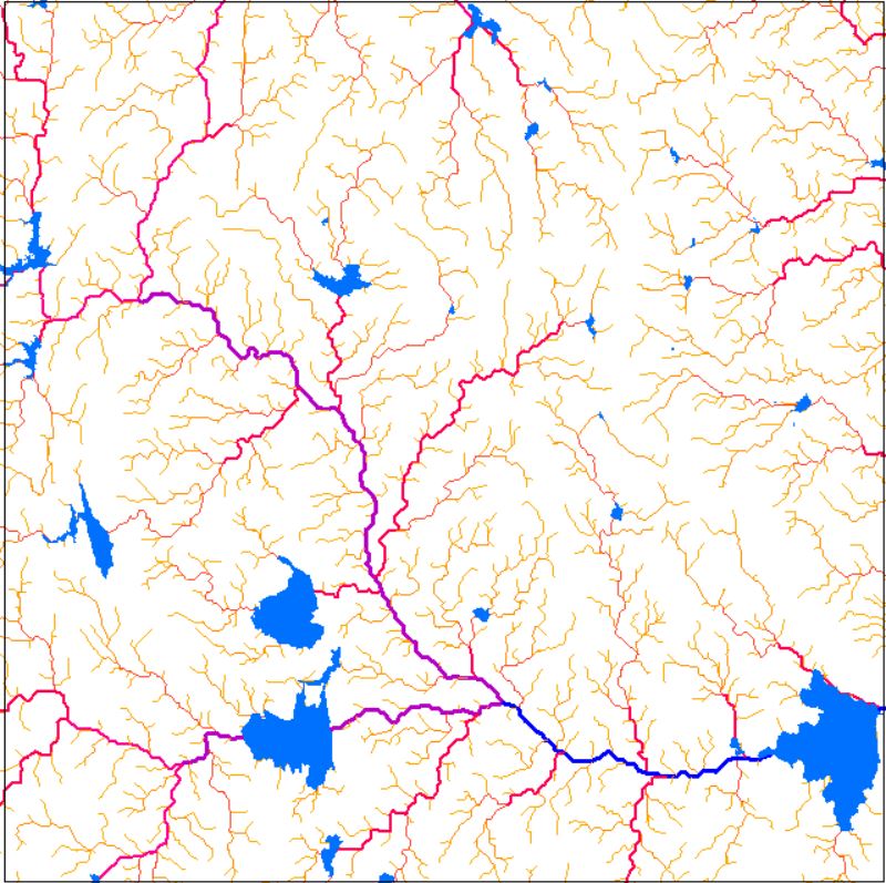
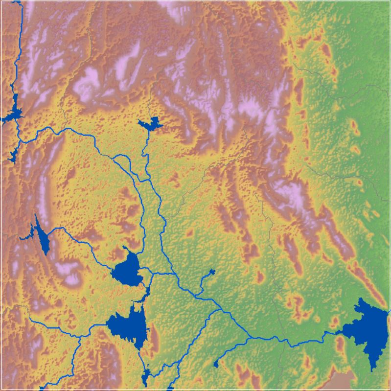
Drainage Network
View more
16 Oct 2020
Drainage Network
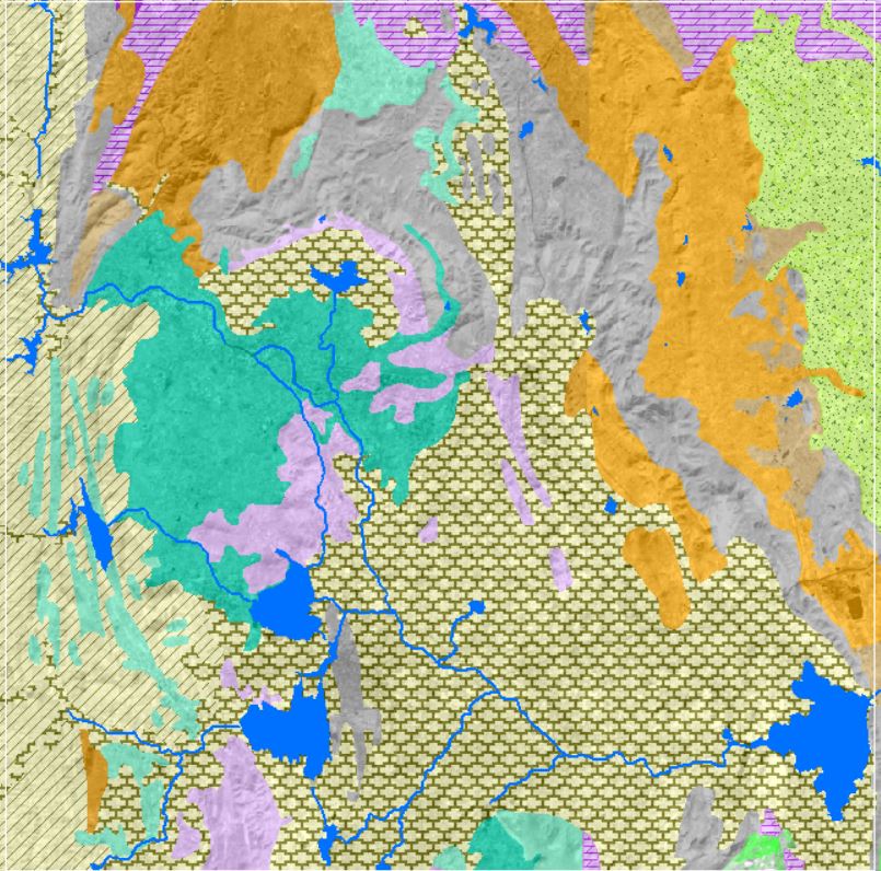
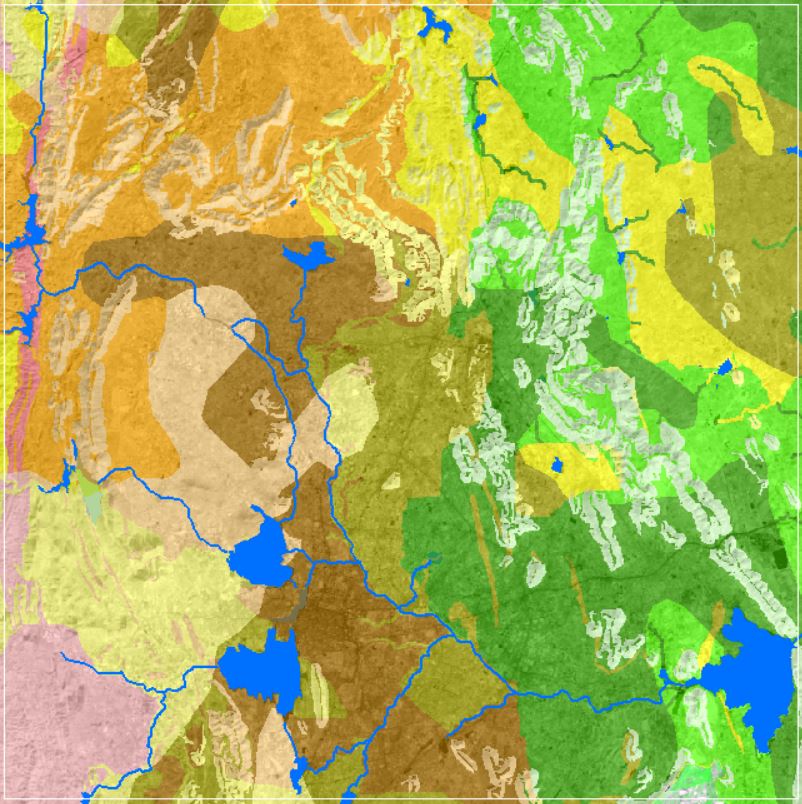
Geology and Lithology
View more
14 Oct 2020
Geology and Lithology
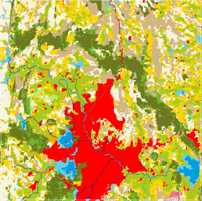
Land Use and Land Cover
View more
6 Oct 2020
Land Use and Land Cover
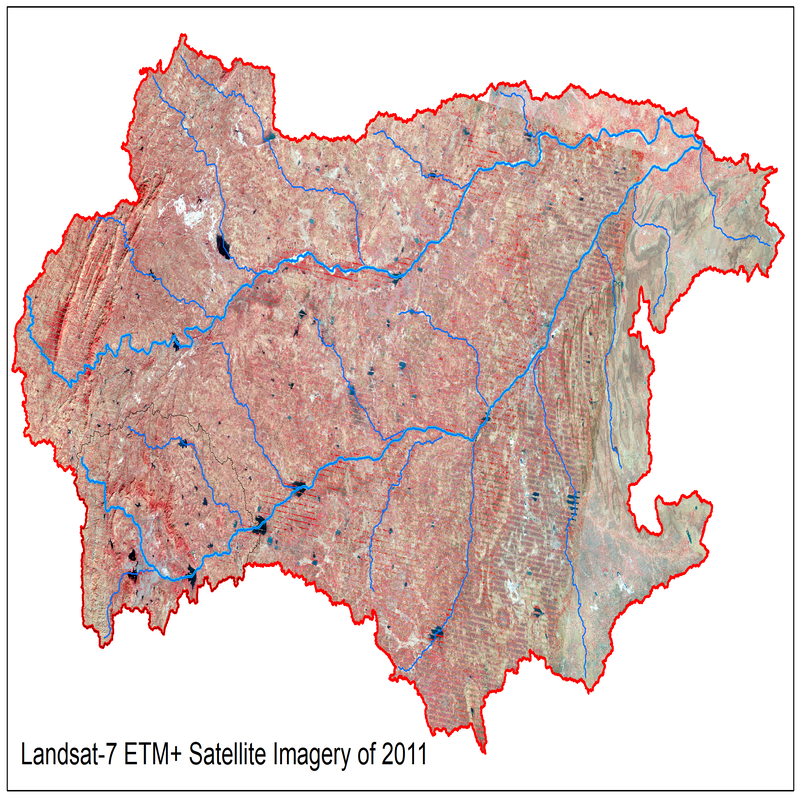
Landsat Satellite Imagery 2011
View more
8 Sep 2020
Landsat Satellite Imagery 2011
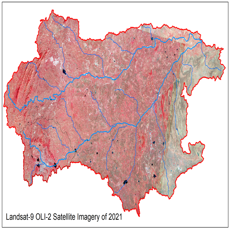
Landsat Satellite Imagery 2021
View more
8 Sep 2020
Landsat Satellite Imagery 2021
Soil Texture Data
View more
12 Sep 2020
Soil Texture Data
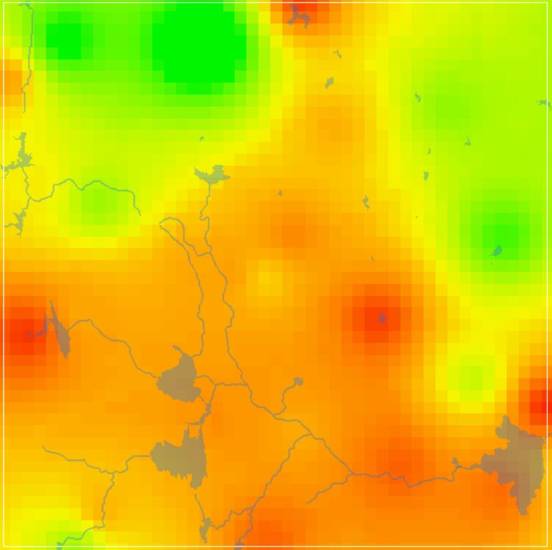
Groundwater Level Data
View more
22 Sep 2020
Groundwater Level Data
SRTM Digital Elevation Model
View more
20 Sep 2020
SRTM Digital Elevation Model